|
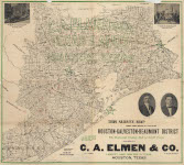
Houston Beaumont
|
1910
|
This Survey Map shows every section of land in the Houston-Galveston-Beaumont District. The Rain and Orange Belt of South Texas. Compliments of C. A. Elem & Co., Largest Land Dealers in Texas, Houston, Texas. Original size 41 x 37 inches.
Includes two photographs of exterior and interior of Elem offices and portraits of C. A. Elmen and C. Glenn Nichols. Map covers ten counties in Southeast Texas.
|
|
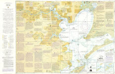
Galveston-Houston Area Circa 1836
|
1986
|
A Replica chart of the Galveston-Houston Area Circa 1836. The History of the Houston-Bay Country Region from the foot of Main Street to the Galveston Bar. Original size 41 x 27 inches.
Heavily annotated with researched historical information. Includes original grants, Native American regions, and geographical information. Current highways are added as reference points. Autograph by Jim Glass.
|
|
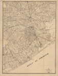
Map Counties Region
|
Nd
|
Harris, Galveston, Fort Bend, Brazoria, and Matagorda county abstracts. Original size 21 x 28 inches.
Includes communities and railroads.
|
|
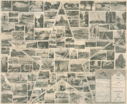
Texas Highway System 1936 (front)
|
1936, 03/01
|
Centennial Edition / Official Map of the Highway System of Texas. A collage of photographs from around the state with the Texas Star in the center, the map was produced by the State Highway Commission.
38 x 31 inches, black and white, sepia toned.
|
|
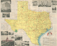
Texas Highway System Map 1936 (back)
|
1936, 03/01
|
Centennial Edition / Official Map of the Highway System of Texas. The map includes U. S. Highways, State Highways, and mileage between towns. Photographs of places of interest for Texas history, the highway department, and the centennial celebration border the map. In the lower right hand corner is the Texas Centennial Song, Texas Over All, with a graphic of six flags above it.
38 x 31 inches, multi-colored.
|