|
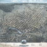
Bird's Eye View of the City of Houston Texas
|
1873
|
Birdseye view. Original not in the collections of the Harris County Archives. Includes numbered references to public buildings, churches, utilities, manufacturers, banks, and railroad depots.
|
|
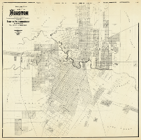
Official Map of the City of Houston and Adjoining Surveys
|
1890
|
Compiled from the Records of Harris County by Porter, Pollard & Ruby, Abstractors of Titles, Real Estate and Insurance Agents. Published by AugGast Bank Notes & Litho. Company, St. Louis. Original Map size 155 x 173 inches. Includes block numbers, names of additions and surveys, ownership, public buildings, cemeteries, railroads, businesses. Map conserved 2014 with funding from Stan Stanart, Harris County Clerk.
|
|
|
|
In addition to the 1890 unified map, the map can also be viewed in six panels.
1890 Official Map of the City of Houston Panel 1
1890 Official Map of the City of Houston Panel 2
1890 Official Map of the City of Houston Panel 3
1890 Official Map of the City of Houston Panel 4
1890 Official Map of the City of Houston Panel 5
1890 Official Map of the City of Houston Panel 6
|
|
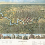
Houston, Texas (Looking South)
|
1891
|
Birdseye view. Original not in the collections of the Harris County Archives. Includes a Directory of Public Buildings, Hotels, Railroads and leading Manufactories and a Church Directory according to denomination and race. Illustrations of the Land and Trust Bank, Electric Power Station of the Houston City Street Railway Company, A. Hampe Dry Goods and Millinery, City Hall and Town Market, Harris County Courthouse, Houston Cotton Exchange. C. C. Gibbs Office Building form the bottom boundary of the map.
|
|
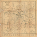
Houston, Street Guide
|
1904
|
Copyright by P. Whitty, Surveyor. Original size 22.5 x 22.5 inches.
Includes city wards, bayous, cemeteries, railroads, significant public and private buildings, and a street key.
Conserved 2008.
|
|
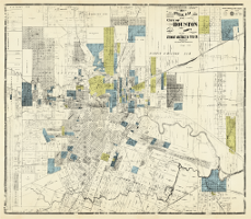
Official Map of the City of Houston and Vicinity
|
1907
|
Compiled and copyrighted by Stewart Abstract & Title Company. Engraved and Printed by State Printing Company, Houston, Texas. Original map size 226 x 198 inches. Includes block numbers, names of additions and surveys, ownership, parks, public buildings, cemeteries, railroads, businesses, street index. Houston Heights, Harrisburg. Map conserved 2014 with funding from Stan Stanart, Harris County Clerk.
|
|
|
|
In addition to the 1907 unified map, the map can also be viewed in six panels.
1907 Official Map of the City of Houston Panel 1 - position 1
1907 Official Map of the City of Houston Panel 2 - position 2
1907 Official Map of the City of Houston Panel 3 - position 3
1907 Official Map of the City of Houston Panel 4 - position 4
1907 Official Map of the City of Houston Panel 5 - position 5
1907 Official Map of the City of Houston Panel 6 - position 6 |
|
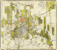
Houston Title Guaranty Co. City of Houston Texas
|
1913
|
A map compiled from photographs of map records, deed records and other official records of Harris Co., Texas. B. J. Dreesen, Draftsman. Copyright Houston Title Guaranty Co. Original map size 200 x 193 inches. Includes block numbers, names of additions and surveys, ownership, parks, public buildings, cemeteries, railroads, businesses, street index. Houston Heights, Harrisburg. Map conserved 2014 with funding from Stan Stanart, Harris County Clerk.
|
|
|
|
In addition to the 1913 unified map, the map can also be viewed in four panels.
Houston Guaranty Panel 1 - position 1
Houston Guaranty Panel 2 - position 2
Houston Guaranty Panel 3 - position 3
Houston Guaranty Panel 4 - position 4 |